A Forest of Sensors


Organization: Massachusetts Institute of Technology
Department: Artificial Intelligence Lab
Principal Investigators: Eric Grimson
Other Investigators: Chris Stauffer
Gideon Stein
Raquel Romano
Lily Lee
Paul Viola
Olivier Faugeras
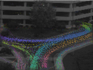
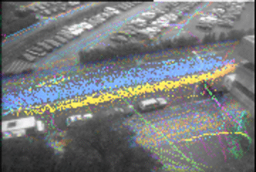
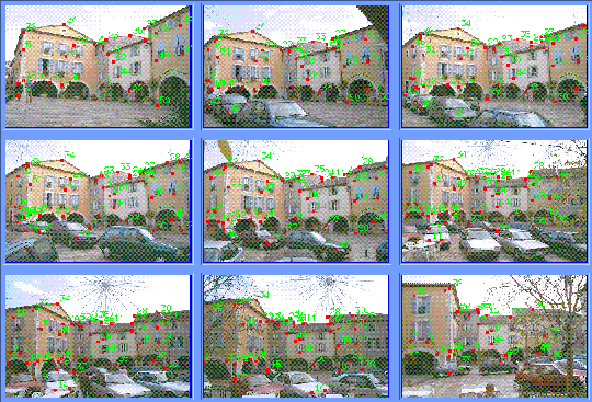
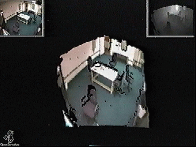
Technical Area: Video Surveillance and Monitoring (VSAM)
Related Pages: A Forest of Sensors: Recent Results

Project Details

Technical Objectives:

Rapid advances in low power micro-electronics means soon cameras, processors, and power supplies will be cheap, reliable and plentiful. Thus, it will soon be possible to build a complete, autonomous, vision module (AVM) using only a few chips. Such a device will be able to function autonomously for weeks at a time, sending information over low bandwidth radio connections. With the addition of a small solar array, an AVM might operate indefinitely. While we won't have the luxury of putting an entire super computer worth of processing on board an AVM, one can easily foresee having 1 GOPS -- about what a good workstation has today.

Integrated with a steerable platform, AVM's can perform autonomous surveillance and make critical visual observations from locations which are simply too dangerous for personnel. But there is another, perhaps more speculative, niche for extremely cheap AVM's. A disposable AVM (dAVM) would be entirely solid-state and have no moving parts. It would be the size of a grenade, a good deal lighter, and just as tough. Dozens if not hundreds could be dropped from planes, scattered throughout a field, or mounted on the rear of every vehicle. A dAVM could act anywhere that an extra pair of eyes might be useful: protecting a perimeter; in surveillance operations; or directing fire. We envision such a collection of dAVMs as a FOREST OF SENSORS, and we believe that developing the capabilities to deploy and most importantly to process the data from such a forest of sensors will revolutionize existing surveillance and monitoring methods.

While we are interested in designing and creating dAVMs, we believe that one can focus on their utilization independent of their design and instantiation. Thus, one can posit the existence of such dAVMs, and ask what activities are made possible by their availability. Many scenarios involving surveillance require monitoring of large amounts of imagery from many vantage points. In short, significant manpower must be expended. Imagine instead, a scenario where 100 dAVM's could be rapidly affixed to trees, rocks, or other elements in an environment. Alternatively, imagine a suite of dAVMs mounted on small drone aircraft. The dAVM's would work in concert, dividing the task of observation automatically among themselves. Together they would immediately identify gaps in the area that can be observed and suggest placement of additional devices. The forest could detect failures of individual units, and use the inherent redundancy of multiple sensors to avoid failure of the ensemble. The forest could use change detection in combination with focus of attention methods to allocate resources to components most able to use them. Given such a forest of small, cheap, robust sensors, a large number of important surveillance tasks becomes feasible, including perimeter patrol, visual mines and urban security.

Our technical focus will be a forest of stationary sensors, although extensions are possible to deal with imagery captured from a moving platform (e.g., an aerial reconnaisance vehicle), by treating the time sequence of images as if from a spatially distributed set of sensors.

In all of the scenarios of interest, it will be difficult to carefully place and calibrate each dAVM. A dAVM must discover its position and its relationship to other dAVM's. Executing geometric self-calibration will enable coordination of the dAVMs to build approximate site models. But the dAVMs must also cooperate in their observations of moving objects. For example, one dAVM whose field of view is the left half of a field must be sure not to add its troop estimates to the dAVM whose field of view is the entire field. Some version of GPS will be helpful here, but it will not solve the entire problem. In order to work in concert, dAVM's will need more than simple camera calibration, they will need a notion of activity calibration.

Even with coordination between dAVMs, the job of monitoring activity is not complete. Imagine dAVMs observing two different villages: in one opposing forces march through a square; in another civilians congregate. Detecting the difference is critical in modern engagements, where losses and civilian casualties must be kept to an absolute minimum. Many features differentiate these scenarios: the uniforms, the weapons, the activity patterns. The latter points to a critical missing component in surveillance, the ability not just to detect basic units of activity but to automatically interpret them. This is a difficult task which is very different from the tasks of change detection and target identification. Much of the success of target recognition has been based on the elegant use of geometric models. Unfortunately, there can be no static geometric model of a platoon walking through a wood, the construction of a revetment, or the passing of a military convoy. In fact, the fundamental question has been changed: target recognition finds objects; what we need is activity recognition.

Technical approach:

Two major technological advances are necessary for the widespread deployment of dAVM's. One: we will need techniques for seamlessly fusing visual information observed at different times and from different locations. Two: we will need a framework in which to construct activity models so activity can be reliably and efficiently detected. An activity model should provide the mechanism both for fusing and interpreting the many available sources of sensory information, i.e., surveillance and monitoring is not just a matter of deploying many sensors. The huge increase in the amount of image data could in principle overwhelm any advantage one obtains by increasing the range of coverage of the sensors. To coordinate their surveillance and monitoring, the dAVMs must:

Military Relevance:

Perimeter Patrol: Protecting a temporary camp's perimeter is a difficult enterprise. Patrols must be organized and a perimeter established. If instead, we have a forest of sensors that have been attached by troops to points on the perimeter, then the surveillance and patrol can be heavily automated. Equipped with low light sensors, each dAVM would detect motion and classify it (e.g.\ animal vs.\ vehicle). If animal, further analysis about location and type could be performed. When enemy incursion is detected, sentries would be immediately advised of the situation. The dAVM's would be so inexpensive that they need not be retrieved, but can continue to observe and report activity throughout the engagement.

Visual Mines: Modern mines are unfortunately non-discriminatory. They are willing to explode when triggered by enemy forces, by civilians and by friendly forces. Imagine replacing explosive mines with ``visual mines''. dAVM's could be placed along key lines of passage, and equipped to trigger a burst of communication to remote observer sites when human activity or vehicle activity is recorded in the vicinity of the mine. This would enable a remote operator to identify friend or foe based on the visual data relayed by the visual mine, to alert nearby troops to investigate, or to coordinate with nearby fire control centers. Note that this is not just a case of placing motion detectors, since such simple systems are likely to overwhelm the operator with tons of false positives. Visual mines should have some ``intelligence'' so that they only alert the operator when they detect instances of likely activity, based either on training from the operator or on generic models of activity.

Urban Security: In urban surveillance and monitoring, a forest of sensors will be able to: i) register different viewpoints and create virtual displays of the facility or area; ii) track and classify objects (people, cars, trucks, bags, etc.); iii) overlay tracking information on a virtual display constructed from the observations of multiple cameras; iv) learn standard behaviors of objects; v) selectively store video. Low bandwidth tracking information could be continually stored allowing the observer to query the system about activities. ``What did the person who left this bag do from 2 minutes before until 2 minutes after leaving it?'' ``Where is that person currently?" ``Show me a video of that person." Tracking information could be used to tag activities such as cars speeding towards the facility, people climbing the perimeter walls, and unusual loitering around the facility.


Progress to date:

Geometric self-calibration of a forest of dAVMs using static and dynamic features. Understanding a dynamically changing scene given data from scattered sensors is a difficult instance of multiple camera self-calibration for several reasons. Because the environment is non-rigid, we cannot rely on traditional methods of correspondence-based calibration for static scenes. Because the sensors may not be perfectly stable, we cannot perform the calibration once and assume its correctness as time progresses. Because the sensors may not have overlapping ranges, we cannot use traditional image-matching techniques to obtain point correspondences.

We are building a system that takes advantage of time-varying data from multiple cameras to obtain point correspondences and perform robust calibration. Our system tracks a moving object in the scene and uses its location at every time step as a single point correspondence among multiple cameras. At every time step, the system stochastically samples the correspondences from the last N frames and recomputes relationships among cameras. Since the system is continually recalibrating itself, it responds to changes in sensor locations by stabilizing after several frames.

Our system is built to function in the many typical scenes found in surveillance and monitoring applications where object motion is confined to be approximately planar so traditional methods that require 3D point correspondences in general position will fail. We use planar correspondences to compute plane homographies between overlapping image pairs and then use the homographies to warp all the images to a single reference image plane. The result is an "extended image" at every time step, and the sequence of extended images simulates a virtual video sequence which contains global information about the multi-camera system, such as which parts of the world are not viewed by a camera, what path a tracked object takes through the extended scene, and what global activities are occurring in the environment. In addition, we are experimenting with decomposing plane homographies in order to constrain the possible locations of cameras in the extended image.

The result of this stage is a method for coordinating imagery from multiple cameras, by using tracked objects to solve for geometric relationship between each of the cameras.


Shown above are three images taken of a scene with a moving object. By automatically tracking and registering the objects, the relative camera geometry is determined. This allows us to merge the views to a single coherent framework, shown below.


Primitive detection of moving objects amongst a forest of dAVMs. Our tracking system uses an adaptive backgrounding method to model the appearance of the scene without any moving objects present. This model approximates the recent RGB values of each pixel with a mixture of Gaussians in the RGB colorspace. The particular Gaussian representing the color which is more consistant and persistant is chosen as the background model.

The pixels in the current image which are not within 2 standard deviations of the background pixel model are assummed to be produced by a moving object. Connected regions of these pixels are used to approximate the position and size of the objects present in each frame. A form of multiple hypothesis tracking is used to determine which regions correspond from frame to frame and to filter regions which are not persistant. The end result is the ability to continuously track multiple discrete objects in an cluttered and changing environment.

The result of this stage is a robust tracking system that can track multiple objects in real time, and acquire statistical data about each tracked object.

Examples of tracking patterns are shown below. The left image shows the observed area, the middle image shows the patterns of tracking, with color encoding direction and intensity encoding speed, and the right image is an overlay of the two. In each case, lanes of vehicle traffic are easily identified, as are standard pedestrian lanes. In the second example, note the large track in the lower right corner. This is an outlier, corresponding to a truck backing into a loading dock, in a region that normally sees only pedestrian traffic.


The following links provide a log dump of the tracking system running continuously. Hourly dumps of a sample image, and the track information for the past hour are provided:

Back of Tech Square

Front of Tech Square

Construction of simple site models from static features. Once an initial calibration has been attained between the sensors, this information can be used to convert the problem of coordinating images into an n-camera stereo problem. If we can identify enough corresponding features between pairs of cameras, this becomes an epipolar computation, whose solution enables us to reconstruct the scene. Such a reconstruction may not be complete, but it enables us to block out major structures, thus enabling the system to reason about occlusions, lines of sight, and to potential register detected activities with static structures in the scene.


An example of the epipolar reconstruction. Shown at left are a set of images, in the center are corresponding match points. Based on this, the epipolar geometry between the cameras is automatically deduced. This enables us to reconstruct a rough site model, as shown below.


An alternative method deals with reconstruction of extended scenes from image sequences. In many cases, we can consider depth maps reconstructed from small camera motions, but often these reconstructions have two problems. First, certain areas are either occluded or the surface is at such a sharp angle to the viewing direction that the reconstruction is not accurate. Second, the reconstructed scene is limited by the viewing angle of the camera and we wish to perform reconstruction on more extended scene.

To deal with this, we have developed (jointly with Shashua at Hebrew University) a method for direct estimation of structure and motion from 3 views (Stein and Shashua CVPR 97). The key feature of that work is that with three views one can directly estimate both structure and motion from image gradients without having to find feature correspondences or optical flow. Shown below are three images from a sequence, plus the depth map recovered for the image in the top left.


Along with the depth map we recover the camera motion. The figure below shows a 3D rendering of the surface.


As a second stage we perform foreground background segmentation. We also remove surfaces where the depth gradient is large (i.e. surfaces that are at a sharp angle to the viewing direction) since these tend to be occluding contours where surface reconstruction is not reliable. The reconstruction works well on surfaces facing the camera but along occluding contours the constant brightness constraint is violated and one gets errors. So as a second stage we perform foreground background segmentation using a K-means algorithm and also remove surfaces where the depth gradient is high. This is shown below.


The final stage is to combine reconstructions from multiple image triplets into a single. For this we use the camera motion estimates which allow us to transform all the surfaces into a common coordinate frame. This leads to a more complete reconstruction. Shown below is an example in which four surface reconstructions from different viewing positions combined to form a more complete reconstruction. The different colors indicate contributions from different reconstructions.


The result of this stage is a method for constructing a rough site model from multiple static views.

Refinement of simple site models using tracking of moving objects. With the ability to calibrate multiple cameras, it will be possible to construct spatial models of the environment. One reconstruction method which can use the information we already have available is reconstruction using accumulated line-of-sight. This method initially models the space as completely occuppied. As objects move in the environment, the regions of space between the camera and the visible parts of the objects is removed from the model. This eventually creates an efficient model of the areas where visible objects can move and where they are occluded.

Shown below are examples of the system reconstructing a site. On the left is a example for the processing, showing the base image, the current image, and the extracted moving object. At the bottom right is the current depth map built from tracking this person. On the right is a reconstruction of the scene, with an image texture mapped onto the detph reconstruction.


The result from this stage is a method for constructing rough site models by tracking moving objects through the scene.

Prototype detectors for people and vehicles. Many of the scenarios to which we intend to apply our monitoring system will involve people and vehicles and the primary moving objects. We need methods to classify tracked objects as belonging to one of a small number of classes (people, cars, trucks, trains, etc.), and then potentially to identify specific instances of class members (which person, what kind of car, etc.). Simple methods for such classification are based on using size and velocity information from the tracked objects. These work surprisingly well, but require a reasonable estimate of the ground plane relative to the cameras. This information can either be obtained from the epipolar reconstruction, or by simply tracking a moving object through the scene and using the variation in size to determine the relative orientation of the ground plane.

More comprehensive detectors are also possible. We have extended earlier work (funded by a DARPA/ONR MURI grant) in flexible template classifiers to create people detectors and vehicle detectors. These templates consist of sets of image regions, connected by flexible springs to allow for spatial deformation. Relative photometric relationships between the regions are used to constrain the templates to detect specific classes of objects, while allowing for a wide range of illumination and material type variation. We have constructed an initial system for detecting vehicles, which is currently undergoing evaluation. A corresponding method for detecting people is under development.

As an example, shown below are examples of using a vehicle template detector (shown at the top of each image), together with results classifying images containing a car or not. Notice that the only error observed is a top view of a car, for which the present template is insufficient.


All of the previous stages can be combined together to build rough models of the site, and to detect moving objects in the site. To identify particular objects, we can use the results of this stage, which provides a method for detecting classes of objects from single images.

Classification of primitive moving objects (e.g. people/animals/vehicles). As noted above, we can use simple properties of tracked objects to classify into categories. In testing, we have found that our tracking system is sufficiently robust to enable a classification based on size and velocity. This allows us to identify, track and count pedestrians, cars, trains, and other vehicles. Such tracking can also determine standard temporal patterns, e.g., what cycles of pedestrian or vehicle traffic are most common? These patterns can then serve as a basis for identifying unusual events, either because they occur in places not normally associated with that event, or at times not normally associated with that event.

Activity calibration of a forest of dAVMs, i.e., coordination of simple Motion monitoring amongst a set of sensors. Our system is currently able to monitor scenes from a single camera in real time, tracking moving objects and recording the associated track information. By collecting statistics on the position, velocity, and size of all moving objects, the system is able to create representations of the activity patterns in the scene. These statistics can then be automatically analyzed to identify common patterns. We are presently exploring several alternatives for this analysis, including a method that clusters track patterns using an Expectation/Maximization algorithm to optimally assign individual observations to clusters. This system is able to identify common pedestrian paths, and vehicle paths. It is also able to isolate unusual outliers, either based on spatial patterns or temporal ones (e.g. a large vehicle driving in a region normally restricted to pedestrian traffic).

Future plans

In the near term, we will build on our existing framework for detecting, tracking and classifying activities, in a variety of directions.
  • We will extend our tracking methods to incorporate multiple cameras. This will require coordination between the cameras to ensure that the same object is being tracked in each, as well as to merge statistical information about the tracked object into a coherent whole.
  • We will examine a set of possible techniques for classifying basic activities from tracked data and associated image information. These will include methods based on Expecatation/Maximation clustering, Hidden Markov Models, Minimum Description Length clustering, and possibly other trainable clustering methods. Basic activities include identifying the type of tracked object (person, vehicle, animal), and detecting instances of objects in scenes.
  • We will extend this set of techniques to classify complex activities, such as interactions between objects, recognizing particular instances of people or vehicles, and detecting common activities between objects.
  • We will develop methods to integrate site models with activity tracking. This will involve using the models to determine interactions between tracked and static objects (e.g. when does a person enter a building, does a person pick up a left object), to determine automatic switching of viewpoints to keep the best camera oriented on a tracked object, and to serve as feedback, i.e. to use the detected motions to update and refine the site model.
  • We will integrate activity detection and classification with recognition systems, to determine specific identities of tracked people and vehicles.
  • We will continue to develop learning systems that can be applied to the problem of classifying patterns of activity.
  • We will develop methods for spotting outliers in the statistical patterns of activity. Such outliers are potential instances of unusual events. We will incorporate recognition methods that further classify such outliers into categories of unusual events.

    Evaluation

    Since this project is primarily aimed at demonstrating proof of concept in the area of multicamera observation and coordination of activity detection and classification, much of our effort will be focused on creating methods to support novel capabilities. Some aspects of this effort are amenable to more rigorous evaluation, and we will execute such tests.
  • We will evaluate the selectivity of our flexible template detectors at identifying instances of objects. We will test this by determining false positive and false negative rates for detectors applied to known databases of images, and by comparing human classification of objects in video sequences.
  • We will statistically evaluate the performance of our tracking system and our classification system, by having human observers scan and classify randomly selected video sequences (e.g. how many vehicles and people are observed and in what directions) and then comparing these statistics to the system's performance.

    Publications

    W.E.L. Grimson, Stauffer, C., Romano R., and Lee, L. Using adaptive tracking to classify and monitor activities in a site. CVPR98.

    Recent Results

    A Forest of Sensors: Recent Results

    Related links

    Principal Investigators
    Last modified: Fri May 15 12:01:21 EDT